
Outdoor Living & Pool Design Planning
Design First. Build Second.
Know exactly what you're building.
Compare builders fairly.
Protect your budget from surprises.
What We Do
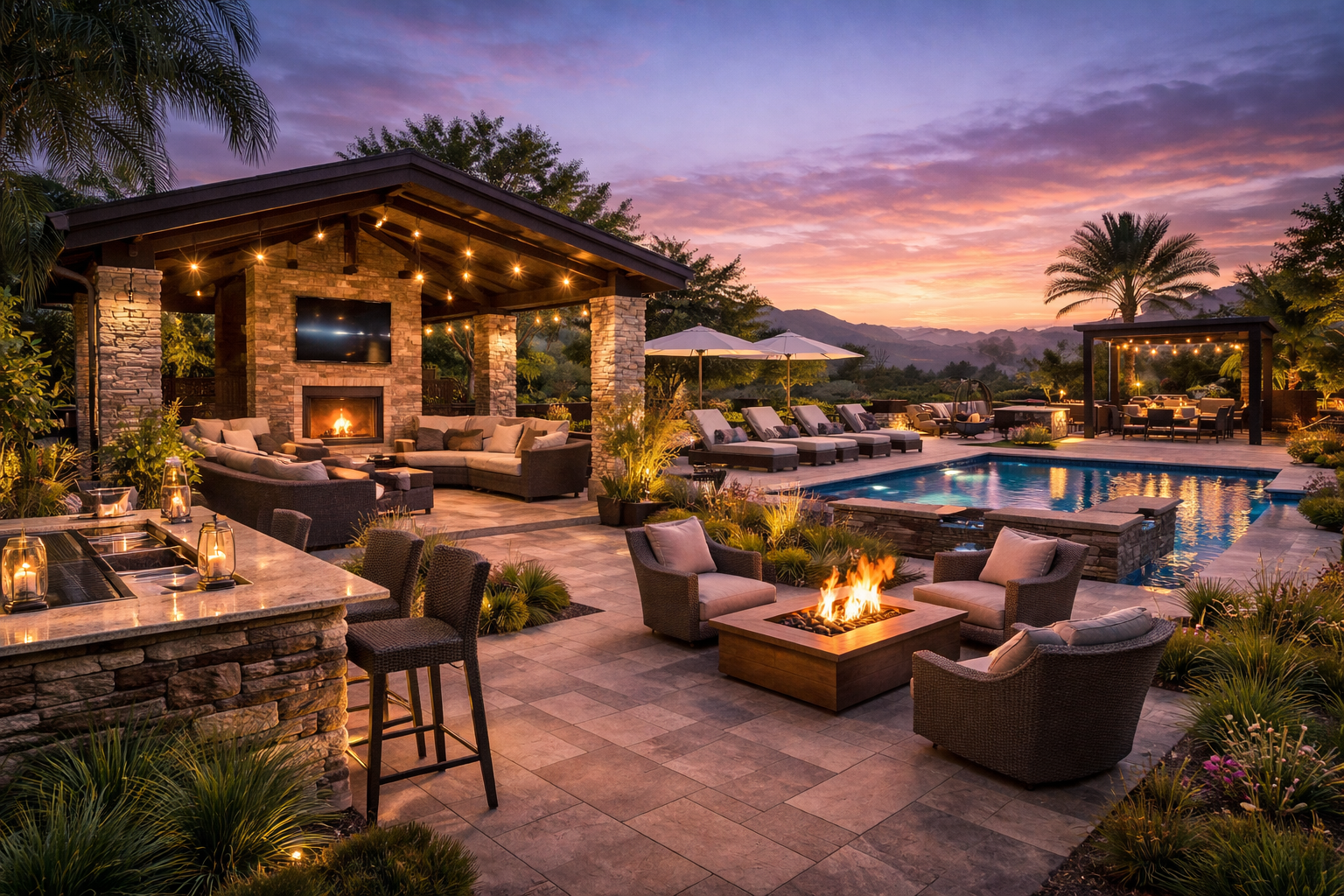
ProTerra Outdoor Design helps homeowners plan custom pools, outdoor living spaces, and backyard transformations before construction begins. Our design-first process ensures every project starts with a clear, buildable plan that aligns vision, budget, and property conditions.
What Clients Say

"My wife and I had an amazing experience working with Jeremy on the design of our new swimming pool. He is not only incredibly experienced, but also extremely enthusiastic about his work. What really stood out to us was how he used the latest technology—drones, computers, and 3D models—to clearly convey his ideas and help us visualize exactly what the final product would look like. This made the entire design process exciting and easy to understand.
— Robbie Davis, Fairhope, AL
⭐️⭐️⭐️⭐️⭐️
"Our interaction with and the service provided by Proterra was exceptional. We have built pools at previous homes but the application of technology and visual support of the unique design components of our project truly made the experience with Proterra outstanding. The Proterra team was really responsive and their work is a must for similar projects. Thank you Proterra Team."
— Scott Rassett. Daphne, AL
⭐️⭐️⭐️⭐️⭐️
"I met Jeremy when I purchased my home in April. I'm not sure how I got so lucky. He has been a trooper! His designs are exactly what I wanted, plus some wonderful ideas that I would never have thought of. He is familiar with all of the new, hi-tech features that are available, today, which is a plus, in my book. He's also quick to respond to any message I send, lol, which I hope isn't a nuisance. I honestly cannot sing his praises enough."
— Kimberly Claments, Pensacola, FL
⭐️⭐️⭐️⭐️⭐️

Most projects start wrong.
Homeowners are told to start with builders.
Without a finalized plan, every bid is built on different assumptions.
What looks comparable isn’t.
Budgets shift.
Scope expands.
Costs rise mid-project.
The mistake isn’t during construction.
It’s before it begins.
Start with a plan, not a price.
Construction Shouldn’t Begin with Guesswork
It should begin with clarity.
A Smarter Way to Plan Your Outdoor Project
1. Map Your Property
We capture precise aerial data to understand elevation, drainage, and layout.
2. Visualize in 3D
See the pool, patio, and outdoor space before build..
3. Compare Builders Fairly
Contractors bid from the same design and scope.
4. Build With Confidence
No guessing. No shifting scope. No surprise pricing.
Plan together. Revise less. Build confidently.
Builders bid from a clear, approved design — not shifting ideas.
See how outdoor living projects evolve through the design process. Watch step-by-step progressions that transform ideas into clear, buildable plans.
Mistakes Start Before the Build
Traditional
1. Call Multiple Builders
Each measures your property differently.
2. Rough Concept on Site
Layout decisions happen during the first visit.
3. Different Designs, Different Assumptions
Every proposal is based on a different vision
.
4. Confusing Estimates
It’s nearly impossible to compare pricing accurately.
5. Adjustments During Construction
Scope shifts and pricing updates follow.
Result:
Uncertainty, expensive adjustments.
VS
PROTERRA
1. Map Your Property First
Precise aerial data captures layout, elevation, and constraints.
2. Design Before Pricing
Your entire project is visualized in 3D before speaking to contractors.
3. One Clear Scope
Every builder bids from the same plan.
4. True Apples-to-Apples Comparison
You evaluate proposals confidently.
5. Build With Clarity
Fewer surprises. Stronger decisions. Better outcomes.
Result:
Clarity, confidence, predictability.
The Difference Isn’t the Project — It’s When Planning Happens
Both approaches build the same project.
The difference is whether design costs are embedded within the proposal — or completed independently before bidding begins.
Traditional Model
Design-First Model
PROTERRA replaces embedded overhead with a focused upfront investment — shifting more of your budget into actual construction value.
Most Budget Surprises Aren’t Construction Problems
They’re planning problems.
When design decisions are made during bidding or after permits, pricing shifts.
Not because anyone made a mistake.
Because clarity came later instead of first.
Designing before pricing creates alignment for homeowners and for builders.
Five Disciplines. One Unified Plan.
Design, measurement, visualization, construction insight, and landscape planning — working together from day one.
“Jeremy’s command of the design software, combined with his creativity and knowledge of the pool design industry and processes, makes ProTerra the perfect partner when designing a backyard pool and hardscape. ”
— Al Duggan, Daphne, AL
Frequently Asked Questions
-
No. Builders build. We plan.
PROTERRA creates a clear, design-ready project so builders can bid accurately and build confidently. -
No — it typically reduces overall project cost.
Independent design avoids embedded sales and marketing overhead and helps prevent expensive changes during construction. -
Yes. Builders prefer bidding from a defined, approved scope because it reduces guesswork and pricing shifts.
-
Builder design is often built into the proposal structure.
Independent design allows you to compare bids fairly and approve every detail before construction begins. -
That’s perfectly fine.
We collaborate with your chosen builder to provide clarity, measurements, and 3D visualization before pricing is finalized. -
Most projects involve separate designers, estimators, and consultants.
PROTERRA unifies drone mapping, 3D visualization, pool planning, construction insight, and landscape design into one coordinated plan.
Who This Is For

Homeowners planning outdoor investments

Homeowners who prioritize clarity before pricing

Projects where apples-to-apples comparison matters

Builders who value defined scope and prepared clients
To protect quality and attention to detail, we intentionally limit the number of projects we accept each quarter.
Start With Clarity
“ProTerra supports builders by providing design-ready projects and informed clients
Builders build, we plan.
Clear roles. Clear pricing.