Contractors & Developers
Bringing Your Projects to Life, One Aerial View at a Time!
📐 Contractor-Centric
ProTerra Imagery delivers precise site data through drone and LiDAR tech—turning it into 3D tools for smarter design, take-offs, and estimates.
🛠️ We Make You Look Sharp
- 📊 Present your services with clarity and confidence
- 🧱 Simplify client decisions with visual design and process tools
- 🕒 Save hours on proposals, revisions, and follow-ups
- 🧠 Get strategic input without hiring in-house
- 🧰 Use branded assets that build trust and win business
- 🔄 Adapt quickly—we’re built for fast turnarounds and changing scopes
3D Design Services
Bring your clients' visions to life with ProTerra Imagery:
- Photorealistic 3D designs for outdoor projects
- Ideal for pool builders, landscapers, and hardscape installers
- Enhance planning, boost sales, and secure client buy-in
- Turn concepts into reality—clearly and confidently
- Let me know if you’d like tagline options pulled from this.
3D Models & Orthomosaic Maps
Help buyers visualize with ProTerra’s immersive tools:
- Interactive 3D models and high-res maps
- Clear views of interior and exterior layouts
- Engaging, informative visuals that boost interest
- Helps buyers picture themselves in the space
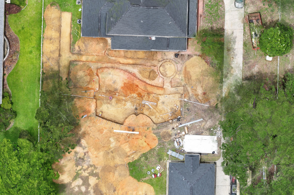
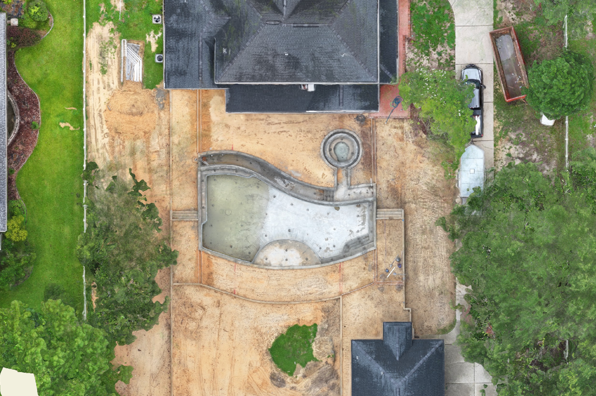
Progress Tracking
ProTerra supports you through every stage of construction:
- “Before” imagery with saved waypoints as a project baseline
- Follow-up drone flights to track progress and quality
- Side-by-side visuals for easy comparison and oversight
- Maintain control and ensure excellence from start to finish
Accurate Take-Offs
ProTerra Imagery delivers accuracy that builds trust:
- Cloud-based drone mapping for precise measurements
- Instantly measure distance, area, volume, and elevation
- Eliminate guesswork with high-res 3D models
- Assess scope, spot challenges, and estimate with confidence
- Enhance proposals and win client trust with visual accuracy
Augmented Reality
ProTerra helps you manage underground utilities with confidence:
- Capture a digital twin before backfilling using drone photogrammetry
- Easily visualize buried elements with augmented reality overlays
- Reduce risk, avoid costly damage, and save time
- Ensure efficient work—even after the trench is closed
Document Overlays
Stay on track with ProTerra’s aerial imaging:
- Overlay scaled plans on high-res drone imagery
- Spot discrepancies early to avoid costly delays
- Real-time issue detection with photogrammetry
- Reduce liability with accurate visual documentation
- Boost credibility and earn client trust
🖼️ Reveal the Impact: Before & After Project Imagery